Reality capture to documentation
From Existing Conditions to Accurate Drawings
MeasureBuilt captures buildings as they actually are, converts them into accurate digital models, and delivers documentation your project team can build from.
Scroll to follow the process
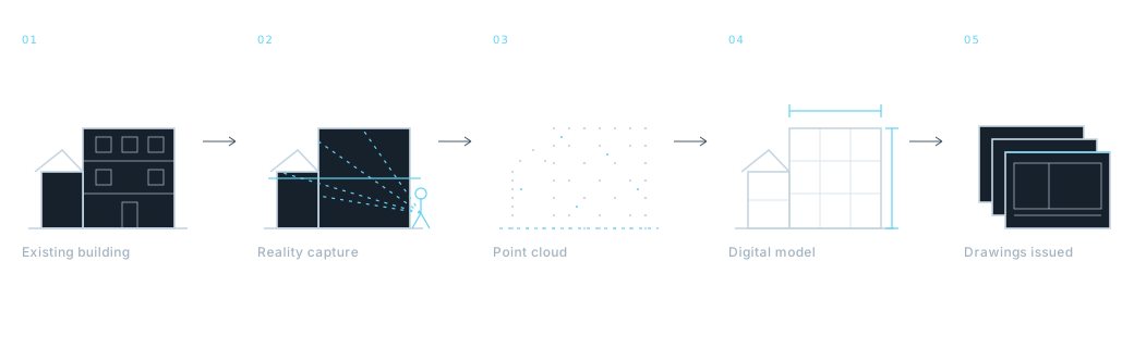
An animated 3D view shows the same building through five stages: site capture with a scanner, a point cloud of the building, a structured digital model, technical processing with a section cut, and the final set of drawings. Every stage is described in text below.
The process
One building, five verified steps
-
01Capture
Capture existing conditions with precision.
A technician scans the building on site with laser measurement and LiDAR — no assumptions, no outdated drawings.
-
02Point cloud
Turn the physical building into measurable spatial data.
The captured points hold the real geometry of the building: openings, levels, structure and envelope, exactly where they are.
-
03Digital model
Convert scan data into an accurate digital building model.
Points become edges, edges become surfaces — a clean model that matches what is actually built, not what was once drawn.
-
04Processing
Process verified conditions into reliable technical documentation.
Levels, sections and dimensions are resolved and checked before anything is issued.
-
05Deliverables
Receive accurate drawings ready for the next stage of your project.
Plans, elevations, sections and the measured model — issued in the formats your project team already works in.
- 01Capture
- 02Point cloud
- 03Model
- 04Processing
- 05Deliverables
Why it matters
Decisions are only as good as the information underneath them
Most delays on existing buildings come from unreliable information about what is actually there. Measured documentation removes that uncertainty before design and construction start.
-
Fewer site revisits
One structured capture replaces repeated trips to re-measure details that were missed or recorded inconsistently.
-
Reliable existing conditions
Documentation reflects the building as it stands today, including alterations that never reached the original drawings.
-
Reduced measurement error
Dimensions come from captured data, not from hand measurements passed between people and formats.
-
Faster coordination
Architects, engineers and contractors work from one shared, consistent description of the building.
-
Clearer planning inputs
Feasibility, fit-out and renovation studies start from verified geometry instead of estimates.
-
Better change control
When conditions are documented up front, fewer surprises turn into variations during construction.
What clients receive
Deliverables your team can work in
The exact package is agreed per project. Typical outputs include:
-
A-101
Floor plans
Measured plans per level, with wall thicknesses, openings and core elements.
-
A-201
Elevations
Façade elevations with openings, levels and visible envelope features.
-
A-301
Building sections
Vertical sections showing floor-to-floor heights and structural relationships.
-
A-401
Roof plans
Roof layout with plant, access and drainage direction where visible.
-
A-501
Reflected ceiling plans
Ceiling layouts where the scope and site access allow them to be captured.
-
M-001
Measured 3D model
The digital building model the drawings are generated from.
-
P-001
Registered point cloud
The processed capture data, for teams that want to work with the source.
-
DOC
As-built documentation set
Coordinated sheets for renovation, permitting and coordination.
File formats — including CAD, model and PDF outputs — are confirmed with your team before capture, so what arrives fits the software you already use.
Accuracy & method
How the work stays verifiable
Every deliverable can be traced back to captured data. Nothing in the drawing set is invented between the site visit and the issued sheet.
Tolerances, level of detail and drawing scope are agreed in writing before capture, so the output matches what the project actually needs.
-
01
Scope & access
Required levels, areas, detail and formats are defined with your team up front.
-
02
On-site capture
Scan positions are planned for coverage, then captured and checked while on site.
-
03
Registration
Individual scans are aligned into one coordinated point cloud of the building.
-
04
Modelling
Geometry is modelled from the registered data, with elements traced to the scan.
-
05
Documentation
Plans, elevations and sections are generated from the model, then reviewed.
-
06
Issue & support
Deliverables are issued in the agreed formats, with follow-up questions answered.
Selected work
Projects built from real-world data
Explore how accurate site capture becomes drawings, CAD files and coordinated 3D models.
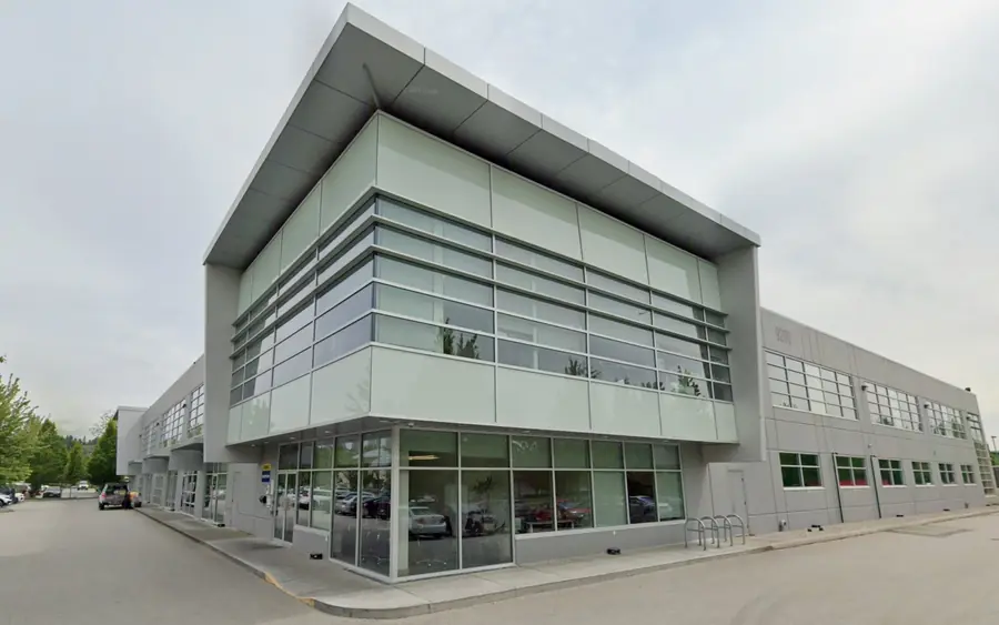
Manufacturing
Manufacturing Facility As-Built Drawings
Handheld laser scanning of a 25,000 SF manufacturing facility in Burnaby, BC. The capture was converted into as-built floor plans and equipment layouts as CAD documentation.
View project
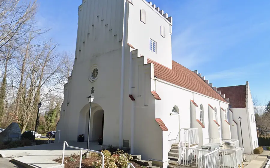
Institutional
Church As-Built Drawings
A multi-level church in Burnaby, BC captured by laser scanning. Point cloud data became CAD as-built plans covering the main, lower, balcony and bell tower levels.
View project
Heritage
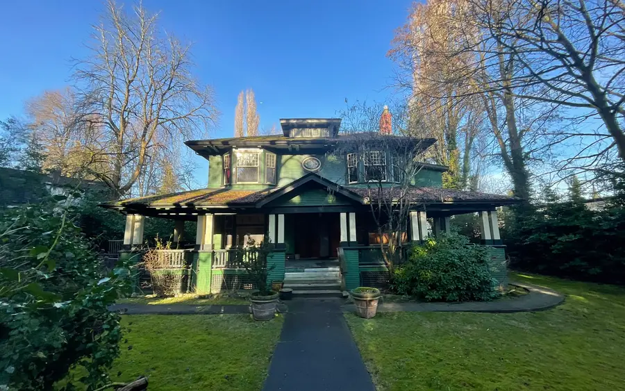
Heritage Home: Laser Scanning to CAD
A 4,200 SF heritage home in Shaughnessy, Vancouver, recorded with a handheld LiDAR scanner. The point cloud became as-built floor plans for renovation and permit use.
View project
Industrial
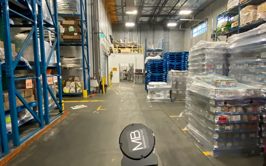
Warehouse As-Built Drawings
A warehouse with integrated offices in Richmond, BC. Laser scanning produced AutoCAD floor plans covering structural gridlines, racking, loading bays and interior office layouts.
View project
Scan to BIM
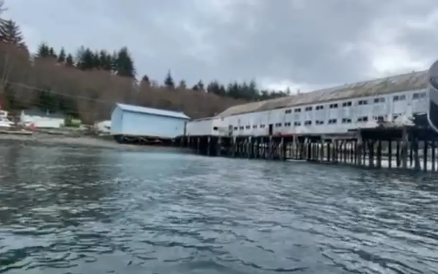
Commercial Pier Revit Model
A remote pier and elevated net house in Northern British Columbia, captured from both land and water. The point cloud became a coordinated 3D Revit model for engineering use.
View project
Request a quote
Tell Us About Your Project
Share the property address, approximate building size, required drawings or digital files, and how the documentation will be used. If available, you can also include existing plans, photos, or project requirements.
- Email info@measurebuilt.ca
- Phone 236-232-3335
-
Office
413-8188 Manitoba Street
Vancouver, BC V5X 4L8
Canada